Suggs Creek, Tennessee
| Suggs Creek, Tennessee | |
|---|---|
| Unincorporated community | |
|
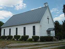
Suggs Creek Cumberland Presbyterian Church | |
| Coordinates: 36°07′07″N 86°29′43″W / 36.11861°N 86.49528°WCoordinates: 36°07′07″N 86°29′43″W / 36.11861°N 86.49528°W | |
| Country | United States |
| State | Tennessee |
| County | Wilson |
| Elevation | 548 ft (167 m) |
| Time zone | Central (CST) (UTC-6) |
| • Summer (DST) | CDT (UTC-5) |
| Area code(s) | 615 |
| GNIS feature ID | 1271741[1] |
Suggs Creek is an unincorporated community in Wilson County, Tennessee, United States. It is located around the intersection of Stewarts Ferry Pike and Corinth Road. The community has a general store (Suggs Creek General Store) and two churches (Suggs Creek Presby[2] & Corinth Road Church of Christ[3]). Suggs Creek is also home to Lucky Lantern Farm, which has been featured on RFD TV.[4] The Community also has a local cemetery that predates the Civil War. The community has roughly 100 rural residences and many farms. It is bordered by Rural Hill, Tennessee to the west, Gladeville to the east and rural Mt. Juliet to the north.
Suggs Creek is found in the southern portion of Wilson County, TN.
Notes
- ↑ "US Board on Geographic Names". United States Geological Survey. 2007-10-25. Retrieved 2008-01-31.
- ↑ http://www.cumberland.org/hfcpc/churches/SuggCrTN.htm
- ↑ http://www.corinthcoc.org/
- ↑ http://www.lanternlanefarm.org/
This article is issued from Wikipedia - version of the 10/20/2014. The text is available under the Creative Commons Attribution/Share Alike but additional terms may apply for the media files.
