Tōkai-Kanjō Expressway
| |
|---|---|
|
| |
| Route information | |
| Length: | 73 km[1] (45 mi) |
| Existed: | 2005[2] – present |
| Major junctions | |
| From: |
Toyota-higashi Junction in Toyota, Aichi |
| To: |
Yokkaichi-kita Junction' in Yokkaichi, Mie |
| Location | |
| Major cities: | Seto, Toki, Minokamo |
| Highway system | |
|
National highways of Japan Expressways of Japan | |
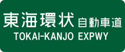
The Tōkai-Kanjō Expressway (東海環状自動車道 Tōkaikanjō Jidōsha-dō) (lit. Tōkai Ring Expressway) is a toll road in the Tōkai region of Japan. It is owned and managed by Central Nippon Expressway Company.
Naming
Officially, the route is designated as National Route 475.[1] On some signs, the expressway is represented in Japanese as 東海環状道; this is done to prevent confusion with the Tōkai-Hokuriku Expressway.
Although the road is named as an expressway, it is not recognized as a national expressway. Officially it is a national highway for motor vehicles only (一般国道の自動車専用道路 Ippan Kokudō no Jidōsha Senyō Dōro)[3] (motor vehicles must have a displacement of at least 125 cc). However, the design standard of the Tōkai-Kanjō Expressway is similar to most national expressways.
Overview
Once completed, the expressway will form a 160 km ring road for the Tōkai Region.[4] It is hoped that the expressway will reduce traffic congestion, link important industrial and manufacturing centers in the region, and facilitate access to Chubu International Airport and tourist areas in rural Gifu Prefecture.
Currently 73 km of the route has been opened to traffic. This section was opened in 2005 to coincide with the opening of Expo 2005 in Aichi Prefecture. There are 4 lanes of traffic from Toyota-higashi Junction to Toki Junction, and 2 lanes from Toki Junction to Mino-Seki Junction.
List of interchanges and features
- IC - interchange, JCT - junction, SA - service area, PA - parking area
| No. | Name | Connections | Dist. from Origin |
Notes | Location | |
|---|---|---|---|---|---|---|
| 1 | Toyota-higashi JCT | 0.0 | Toyota | Aichi | ||
| 2 | Toyota-Matsudaira IC | 3.4 | ||||
| PA | Kuragaike PA | 6.3 | Highway Oasis | |||
| 3 | Toyota-Kanpachi IC | 9.7 | ||||
| 4 | Toyota-Fujioka IC | Pref. Route 13 (Toyota Tajimi Route) | 15.4 | |||
| 5 PA |
Seto-Akazu IC/PA | Pref. Route 22 (Seto Kanjō Route) Pref. Route 33 (Seto Shitara Route) |
23.2 | Seto | ||
| 6 | Seto-Shinano IC | 26.0 | ||||
| 7 | Toki-minami Tajimi IC | Pref. Route 382 (Toki-minami Inter Route) | 36.9 | Toki | Gifu | |
| 30-1 | Toki JCT | 39.8 | ||||
| PA | Gotomaki PA | 41.5 | ||||
| 8 | Kani-Mitake IC | 50.3 | Kani | |||
| Mitake | ||||||
| 9 SA |
Minokamo IC/SA | Pref. Route 342 (Heisei Kinen Kōen Route) |
59.7 | Highway Oasis | Minokamo | |
| 10 | Tomika-Seki IC | Pref. Route 58 (Seki Kanayama Route) Pref. Route 343 (Tomika Mino Route) |
66.0 | Tomika | ||
| 5-1 | Mino-Seki JCT | 73.0 | ||||
| Mino | ||||||
| 11 | Seki-Hiromi IC | 75.9 | Opened in 2008 | Seki | ||
| <12> | Takatomi IC | - | Planned | Yamagata | ||
| <13> | Gifu-Yamagata IC | - | Planned | Gifu | ||
| <14> | Motosu IC | - | Planned | Motosu | ||
| <15> | Ōno-Gōdo IC | Pref. Route 92 (Gifu Sunami Ōno Route) | - | Planned | Ōno | |
| <16> | Ōgaki-nishi IC | - | Planned | Ōgaki | ||
| <26-1> | Yōrō JCT | - | Planned | Yōrō | ||
| <17> | Yōrō IC | Pref. Route 30 (Hashima Yōrō Route) | - | Planned | ||
| <18> | Kisei IC | - | Planned | Inabe | Mie | |
| <19> | Daian IC | - | Planned | |||
| <20> | Tōin IC | Pref. Route 3 (Kuwana Daian Route) | - | Planned | Tōin | |
| <17> | Yokkaichi-kita JCT | - | Planned | Yokkaichi | ||
References
- 1 2 Ministry of Land, Infrastructure and Transport. "Road Timetable". Retrieved 2008-04-18.
- ↑ Ministry of Land, Infrastructure and Transport. "History of the Expressway Network in the Greater Nagoya Area". Retrieved 2008-04-17.
- ↑ Ministry of Land, Infrastructure and Transport. "High Standard Trunk Road Map" (pdf). Retrieved 2008-04-13.
- ↑ "Nagoya Urban Institute Project Page". Retrieved 2008-04-18.