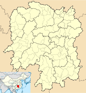
Yueyanglou District
| Yueyanglou 岳阳楼区 | |
|---|---|
| District | |
 Yueyanglou Location in Hunan | |
| Coordinates: 29°20′45″N 113°12′42″E / 29.3458°N 113.2116°ECoordinates: 29°20′45″N 113°12′42″E / 29.3458°N 113.2116°E | |
| Country | People's Republic of China |
| Province | Hunan |
| Prefecture-level city | Yueyang |
| Time zone | China Standard (UTC+8) |
Yueyanglou District (simplified Chinese: 岳阳楼区; traditional Chinese: 岳陽樓區; pinyin: Yuèyánglóu qū) is one of three urban districts of Yueyang, Hunan province, China, named after the Yueyang Tower within its confines. It is situated on the southeastern (right) bank of the Yangtze River.
Administrative Divisions
According to the result on adjustment of township-level administrative divisions of Yueyanglou District on November 30, 2015, Yueyanglou has 2 townships and 1 town and 17 subdistricts under its jurisdiction,[1] they are:
- Guozhen (郭镇乡)
- Kangwang (康王乡)
1 town
- Xitang, Yueyang (西塘镇)
17 subdistricts
- Chenglingji (城陵矶街道)
- Dongmaoling (东茅岭街道)
- Dongting, Yueyang (洞庭街道)
- Fengshuhu (枫桥湖街道)
- Hubin, Yueyang (湖滨街道)
- Jin'eshan (金鹗山街道)
- Luowang, Yueyang (洛王街道)
- Lüxianting (吕仙亭街道)
- Nanhu, Yueyang (南湖街道)
- Qijialing (奇家岭街道)
- Qiusuo (求索街道)
- Sanyanqiao (三眼桥街道)
- Wangjiahe (王家河街道)
- Wangyuelu (望岳路街道)
- Wulipai, Yueyang (五里牌街道)
- Yueyanglou subdistrict (岳阳楼街道)
- Zhanqianlu (站前路街道)
References
- ↑ According to the result on adjustment of township-level administrative divisions of Yueyanglou District, Yueyang, Hunan province on November 30, 2015: rednet (2015-12-04), also see hunan.gov (2015-12-07)
- www.xzqh.org (Chinese)
This article is issued from Wikipedia - version of the 11/11/2016. The text is available under the Creative Commons Attribution/Share Alike but additional terms may apply for the media files.