Burnt Woods, Oregon
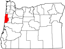
Burnt Woods is an unincorporated community in Lincoln County, Oregon, United States.[1] It is located about 16 miles (26 km) west of Philomath on U.S. Route 20 in the Central Oregon Coast Range near the Tumtum River.[2]
Burnt Woods post office was established in 1919, after the name was chosen from a list of proposed names sent to the Post Office Department.[3] The signs of past forest fires are still evident in the area.[3] Burnt Woods post office closed in 1978.[3]
The community has a store and a café.[4][5][6] The store has been operating since the early 1920s.[5] The café was opened in 1925 and has seen several ownership changes since then.[7]
Ellmaker State Wayside is located about 1 mile (1.6 km) north of Burnt Woods, accessed westbound on U.S. Route 20.
References
- ↑ "Burnt Woods". Geographic Names Information System. United States Geological Survey. November 28, 1980. Retrieved 2011-01-09.
- ↑ Oregon Atlas & Gazetteer (7th ed.). Yarmouth, Maine: DeLorme. 2008. p. 32. ISBN 0-89933-347-8.
- 1 2 3 McArthur, Lewis A.; McArthur, Lewis L. (2003) [1928]. Oregon Geographic Names (7th ed.). Portland, Oregon: Oregon Historical Society Press. p. 129. ISBN 978-0875952772.
- ↑ Friedman, Ralph (1990). In Search of Western Oregon (2nd ed.). Caldwell, Idaho: The Caxton Printers, Ltd. p. 197. ISBN 0-87004-332-3.
- 1 2 Downing, Kathi (July 14, 2005). "Burnt Woods Store: Peel Back the Layers of History". Corvallis Gazette-Times. Retrieved 2011-01-09.
- ↑ Odegard, Kyle (April 7, 2008). "Coast On In". Corvallis Gazette-Times. Retrieved 2011-01-09.
- ↑ Idzerda, Evelyn (April 18, 2002). "Burnt Woods Cafe to Reopen". Corvallis Gazette-Times. Retrieved 2011-01-09.
External links
- Historic images of Burnt Woods from Salem Public Library
Coordinates: 44°36′13″N 123°37′22″W / 44.603731°N 123.622885°W
