Georgetown, Prince Edward Island
| Georgetown | |
|---|---|
| Town | |
|
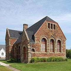
Georgetown Post Office | |
 Georgetown in Prince Edward Island | |
| Coordinates: 46°11′05″N 62°32′01″W / 46.18459°N 62.53362°WCoordinates: 46°11′05″N 62°32′01″W / 46.18459°N 62.53362°W | |
| Country | Canada |
| Province | Prince Edward Island |
| County | Kings County |
| Parish | St. George's Parish |
| Founded | 1732 |
| Incorporated | 1912 |
| Government | |
| • Type | Town Council |
| • Mayor | Lewis Lavandier |
| • Deputy Mayor | Wade Williams |
| • Councillors |
Faye McQuillan Allan Gallant Michael Gallant Toby Murphy Mark Stephen |
| Area | |
| • Land | 1.65 km2 (0.64 sq mi) |
| Population (2006) From Statistics Canada | |
| • Total | 693 |
| • Density | 384.7/km2 (996/sq mi) |
| Time zone | AST (UTC-4) |
| • Summer (DST) | ADT (UTC-3) |
| Canadian Postal code | C0A 1L0 |
| Area code(s) | 902 |
| Telephone Exchange | 652 |
| NTS Map | 011L02 |
| GNBC Code | BABDH |
Georgetown is a Canadian town and the county seat of Kings County, Prince Edward Island. As of 2011, the population was 693.
History
This area of eastern Prince Edward Island traces its history of human settlement to the Mi'kmaq Nation which inhabited the area. These people were referred to as "Epegoitnag" and for them, the region was an Acadian forest wilderness containing wild game, as well as fruit, berries and wild nuts for gathering, as well as plentiful marine resources in the nearby rivers and Northumberland Strait. The land in this area was called "Samkook" which translates to 'the land of the sandy shore'.

Georgetown lies opposite Brudenell Point, which divides the Brudenell River to the north from the Montague River to the south. Brudenell Point was the location of the first permanent Acadian settlement on what the French called Ile-Saint-Jean. Here, entrepreneur Jean Pierre Roma landed in 1732 with approximately 100 settlers to begin a commercial settlement to grow food and catch fish for provisioning the French military garrison at Fortress of Louisbourg on Ile-Royale (now Cape Breton Island). French settlers called the area Trois-Rivieres (Three Rivers). The British burned the village in 1745, the same time they took control of Port-la-Joye.
Following the transfer of control of Acadia to Britain at the conclusion of the Seven Years' War in 1763, the British government survey of St. John's Island by Captain Samuel Holland selected the entirety of Cardigan Point for the capital of Kings County and designated it as the township of Kings Royalty.
The county capital was to be named Georgetown in honour of King George III. The settlement was oriented on magnetic north and a broad street network was designed.
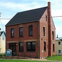
Present-day Georgetown's collection of venerable and beautiful heritage buildings mostly dates to the late Victorian Era at the height of Georgetown's importance in the wooden shipbuilding industry. As one of the most important ports in the colony of Prince Edward Island, the port was selected in 1870 to be the eastern terminus of the Prince Edward Island Railway (PEIR) and became a vital steamship terminal with connections to the Intercolonial Railway on the mainland at Pictou, Nova Scotia. Georgetown's harbour was frequently the only port on the island to be usable during the winter months on account of prevailing wind and tide directions (this being before the Canso Causeway altered sea ice patterns in the Northumberland Strait).
The Port of Georgetown is a deep water harbour situated in Cardigan Bay on the east coast of Prince Edward Island, south of the Port of Souris. The port remains ice-free from April 15 through December 31 and shipping through winter is not required by any of the current clientele. Georgetown is approximately 100 km from the port of Charlottetown.[1]
The PEIR mainline from Georgetown extended through Montague Junction (where a spur was built to service nearby Montague) to Mount Stewart and on to Royalty Junction (connection to Charlottetown), Summerside and Alberton.
In the 20th century, Georgetown's industrial base diversified to include the Island's only shipyard, East Isle Shipyard, now owned by J.D. Irving Limited (JDI), and well known for its construction of tugs such as Atlantic Spruce, Atlantic Oak and the Royal Canadian Navy's Glen class tugs.
The town is also home to the Island's largest saw mill (also owned by JDI). A major seasonal employer is a seafood plant, operated by Seafood 2000 and originally constructed by National Sea Products Limited.
Local attractions
- Georgetown is adjacent to Brudenell River Provincial Park which hosts a campground and tourist accommodations. Two of the province's top golf courses, Brudenell River Golf Course and Dundarave Golf Course, are located at the Brudenell River Resort.
- A lit boardwalk on the water with benches, lookouts, a gazebo and access to the beach.
- The Confederation Trail works its way through Georgetown offering wonderful water views, perfect for walking or cycling.
- 10 historical buildings are listed in Georgetown and there is a walking tour to show visitors these and other buildings of interests.
- A.A. Macdonald Memorial Park is the largest botanical garden in Prince Edward Island. it commemorates one of Canada's Fathers of Confederation Andrew Archibald Macdonald. In 2015 it was nominated as one of Canada's Great Places[2]
- Maroon Pig Art Gallery & Sweet Shop www.maroonpig.ca
Geography
Georgetown, Capital of Kings County, sits on an 8 kilometre long peninsula formed by the Cardigan and Brudenell Rivers, Along with Georgetown Harbour. This peninsula forms part of the township of Kings Royalty and extends into Cardigan Bay, a sub-basin of the Northumberland Strait to the east.
Georgetown Harbour is a deep natural harbour and lies to the south of the town at the confluence of the Brudenell River and the Montague River.
Climate
| Climate data for Alliston (approximately 9.2 Km away from Georgetown)[3] | |||||||||||||
|---|---|---|---|---|---|---|---|---|---|---|---|---|---|
| Month | Jan | Feb | Mar | Apr | May | Jun | Jul | Aug | Sep | Oct | Nov | Dec | Year |
| Record high °C (°F) | 15.0 (59) |
15.0 (59) |
18.3 (64.9) |
26.1 (79) |
30.6 (87.1) |
32.8 (91) |
33.9 (93) |
36.1 (97) |
32.2 (90) |
25.0 (77) |
21.1 (70) |
17.8 (64) |
36.1 (97) |
| Average high °C (°F) | −2.0 (28.4) |
−1.9 (28.6) |
2.5 (36.5) |
7.1 (44.8) |
14.7 (58.5) |
20.8 (69.4) |
23.9 (75) |
23.5 (74.3) |
18.7 (65.7) |
12.3 (54.1) |
6.5 (43.7) |
1.2 (34.2) |
10.6 (51.1) |
| Daily mean °C (°F) | −6.6 (20.1) |
−6.6 (20.1) |
−1.9 (28.6) |
2.9 (37.2) |
9.4 (48.9) |
15.3 (59.5) |
19.1 (66.4) |
18.6 (65.5) |
14.1 (57.4) |
8.4 (47.1) |
3.0 (37.4) |
−2.8 (27) |
6.1 (43) |
| Average low °C (°F) | −11.3 (11.7) |
−11.2 (11.8) |
−6.2 (20.8) |
−1.3 (29.7) |
4.1 (39.4) |
9.7 (49.5) |
14.1 (57.4) |
13.8 (56.8) |
9.5 (49.1) |
4.4 (39.9) |
−0.5 (31.1) |
−6.9 (19.6) |
1.5 (34.7) |
| Record low °C (°F) | −31.0 (−23.8) |
−26.7 (−16.1) |
−27.8 (−18) |
−15.0 (5) |
−6.7 (19.9) |
−3.9 (25) |
2.0 (35.6) |
4.4 (39.9) |
−0.6 (30.9) |
−6.1 (21) |
−13.3 (8.1) |
−23.9 (−11) |
−31.0 (−23.8) |
| Average precipitation mm (inches) | 96.3 (3.791) |
72.7 (2.862) |
78.7 (3.098) |
92.4 (3.638) |
87.7 (3.453) |
90.0 (3.543) |
93.6 (3.685) |
87.8 (3.457) |
112.2 (4.417) |
122.6 (4.827) |
120.2 (4.732) |
127.9 (5.035) |
1,182.2 (46.543) |
| Average rainfall mm (inches) | 42.6 (1.677) |
30.2 (1.189) |
41.2 (1.622) |
68.5 (2.697) |
86.1 (3.39) |
90.0 (3.543) |
93.6 (3.685) |
87.8 (3.457) |
112.2 (4.417) |
120.5 (4.744) |
106.8 (4.205) |
83.6 (3.291) |
963.1 (37.917) |
| Average snowfall cm (inches) | 53.8 (21.18) |
42.5 (16.73) |
37.5 (14.76) |
24.0 (9.45) |
1.6 (0.63) |
0.0 (0) |
0.0 (0) |
0.0 (0) |
0.0 (0) |
2.1 (0.83) |
13.4 (5.28) |
44.7 (17.6) |
219.5 (86.42) |
| Average precipitation days (≥ 0.2 mm) | 13.4 | 10.6 | 12.7 | 14.7 | 14.1 | 12.2 | 12.1 | 11.6 | 14.3 | 16.2 | 15.8 | 15.9 | 163.5 |
| Average rainy days (≥ 0.2 mm) | 5.8 | 4.6 | 7.9 | 11.8 | 14.0 | 12.2 | 12.1 | 11.6 | 14.3 | 16.0 | 14.2 | 9.8 | 134.3 |
| Average snowy days (≥ 0.2 cm) | 9.0 | 7.3 | 6.7 | 4.4 | 0.18 | 0.0 | 0.0 | 0.0 | 0.0 | 0.28 | 2.9 | 8.4 | 39.1 |
| Source: Environment Canada[4] | |||||||||||||
See also
References
- ↑ "Port of Georgetown, PEI, Canada"
- ↑ Great Places Canada nomination. Accessed October 2, 2015
- ↑ "Station Results - Advanced Search". Environment Canada. Retrieved March 24, 2015.
- ↑ "Alliston, Prince Edward Island". Canadian Climate Normals 1971–2000. Environment Canada. Retrieved April 9, 2015.
