Ipswich River Wildlife Sanctuary
 Ipswich River Wildlife Sanctuary
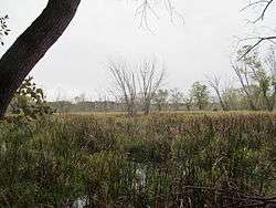
The Ipswich River Wildlife Sanctuary, which is the Massachusetts Audubon Society’s largest wildlife sanctuary, is located in Topsfield and Wenham, Massachusetts. Much of its 2,800-acre (11 km2) landscape was created by a glacier 15,000 years ago.
The sanctuary features more than ten miles (16 km) of interconnected trails wind through forests, meadows, and swamps, vernal pools, drumlins, and eskers. The Rockery Trail runs beside large rocks, exotic trees, and shrubs that belonged to an arboretum at Bradstreet Farm, parts of which were donated by owner Thomas Emerson Proctor. The Ipswich River runs for eight miles (13 km) through the sanctuary, and Mass Audubon makes canoes available for members to rent.
The Sanctuary also offers summer camps and various nature programs for children and adults.
References
External links
Coordinates: 42°37′28.15″N 70°54′34.34″W / 42.6244861°N 70.9095389°W / 42.6244861; -70.9095389
|
|---|
|
|
|
|
|
|
|
| Wildlife Management Areas |
|---|
| Wildlife
Management Areas | |
|---|
| Wildlife
Sanctuaries |
- Billingsgate Island
- Carr Island
- E. Howe Forbush
- Egg Rock
- Grace A. Robson
- J.C. Phillips
- Knight
- Penikese Island
- Ram Island (Salisbury)
- Ram Island (Mattapoisett)
- Susan B. Minns
- Tarpaulin Cove
- Watatic Mountain
|
|---|
|
|
|
| |
|---|
|
- Black Pond Bog
- Boat Meadow
- Francis Newhall Woods
- Grassy Pond
- Greene Swamp
- Halfway Pond Island
- Hawley Bog
- Hockomock Swamp
- Hoft Farm
- Homer-Watcha Preserve
- Katama Plains
- McElwain-Olsen
- Miacomet Moors
- Reed Brook
- Drury
- Sandy Neck
- David H. Smith Preserve and Fire Trail
- Stacy Mountain
- Tatkon
|
|
|
|
|
|
|
|
|
|
