Lower West Side, Chicago
| Lower West Side Pilsen | |
|---|---|
| Community area | |
| Community Area 31 - Lower West Side | |
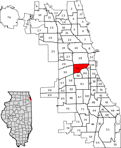
 Location within the city of Chicago | |
| Coordinates: 41°51′N 87°39.6′W / 41.850°N 87.6600°WCoordinates: 41°51′N 87°39.6′W / 41.850°N 87.6600°W | |
| Country | United States |
| State | Illinois |
| County | Cook |
| City | Chicago |
| Neighborhoods | |
| Area | |
| • Total | 2.80 sq mi (7.25 km2) |
| Population (2010) | |
| • Total | 35,769 |
| • Density | 13,000/sq mi (4,900/km2) |
| Demographics 2010[1] | |
| • White | 20.43% |
| • Black | 3.10% |
| • Hispanic | 73.43% |
| • Asian | 1.04% |
| • Other | 1.00% |
| Time zone | CST (UTC-6) |
| • Summer (DST) | CDT (UTC-5) |
| ZIP Codes | parts of 60608 and 60616 |
| Median household income | $34,573[2] |
| Source: U.S. Census, Record Information Services | |
Lower West Side is a community area on the West Side of Chicago, Illinois, United States. It is three miles southwest of the Chicago Loop, and its main neighborhood is Pilsen. The Heart of Chicago is a neighborhood in the southwest corner of the Lower West Side.
History
In the late 19th century, Pilsen was inhabited by Czech immigrants who named the district after Plzeň, the fourth largest city in what is now the Czech Republic. They replaced the Germans and Irish who had settled there before them, in the mid-nineteenth century. The population also included smaller numbers of other ethnic groups from the Austro-Hungarian Empire, such as Slovaks, Slovenes, Croats and Austrians, as well as immigrants of Polish and Lithuanian heritage. Many of the immigrants worked in the stockyards and surrounding factories. Like many early 20th century American urban neighborhoods, however, Pilsen was home to both wealthy professionals and the working class, with the whole area knitted together based on the ethnicities, mostly of Slavic descent, who were not readily welcome in other areas of the city. [3]
Although there was some increase in the Hispanic presence in the late 1950s, it was not until the early 1960s that there was a great spurt in the numbers of Latinos in Pilsen. This was due to the displacement of Latinos from the neighborhood UIC currently occupies,[4] south of Hull House,[5] and from other urban revitalization projects.[4] In 1970, Latinos became the majority population in Pilsen, with about 25,000 people out of the community's 43,341 people surpassing the population of people of Eastern European descent. In particular Mexicans made up about 36% of the residents of Pilsen in 1973.[6]
In the 1980s, the Mexican origin population grew. During that decade 95% of the people in Pilsen had some Mexican descent, and 80% of the overall population of Plsen were first or second generation immigrants from Mexico and Mexican-Americans. Mexican growth continued into the 1990s. During that decade 40% of the Mexican origin population in Pilsen had migrated directly there from Mexico, and about 33% of the Mexican origin population in the Chicago area lived in Pilsen.[6]
As of 2005 many of the newer residents of the neighborhood were not Latino, and it is projected that the neighborhood will continue to become more diversified in the years ahead.[7] The non-Latino population in Pilsen is still a minority as of the 2010 Census.
The Chicago Housing Authority's plan for transformation of the ABLA projects has spilled over into Pilsen proper, with the now nearly complete Chantico Loft development, Union Row Townhomes, as well as the defunct Centro 18 on 18th Street in East Pilsen. Infill construction of condominiums and single family homes is now in full force on the east side of the neighborhood, as Pilsen becomes one of the next major development areas for infill construction. Some local advocacy groups, including one led by Michael A. Martone, have formed urging the neighborhood's alderman to curtail gentrification to preserve the Mexican-American culture.
| Historical population | |||
|---|---|---|---|
| Census | Pop. | %± | |
| 1930 | 66,198 | — | |
| 1940 | 57,908 | −12.5% | |
| 1950 | 53,991 | −6.8% | |
| 1960 | 48,448 | −10.3% | |
| 1970 | 44,535 | −8.1% | |
| 1980 | 44,951 | 0.9% | |
| 1990 | 45,654 | 1.6% | |
| 2000 | 44,031 | −3.6% | |
| 2010 | 35,769 | −18.8% | |
| [8] | |||
National Historic Register
In 2006, Pilsen Historic District became a National Historic Register District. South Water Market has been added to the National Register of Historic Places.
Layout
The east side of the neighborhood along Halsted Street is one of Chicago's largest art districts, and the neighborhood is also home to the National Museum of Mexican Art. St. Adalbert's dominates the skyline with the opulence typical of churches in the Polish Cathedral style.
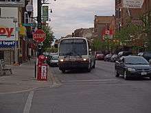
W 18th Street is an active commercial corridor, with Mexican bakeries, restaurants and groceries, though the principal district for Mexican shopping is W 26th Street in Little Village, Chicago's other formerly majority Pan-Slavic community.
The United States Postal Service operates the Pilsen Post Office on 1859 S Ashland Avenue.[9]
The National Museum of Mexican Art is located in the Pilsen neighborhood.
Cuisine
Robb Walsh of the Houston Press wrote that the Mexican restaurants in Pilsen are "unconsciously authentic" to original Mexican cuisine. According to Rick Bayless, the chef and owner of Frontera Grill, this is because Mexican-Americans in Chicago do not encounter a substantial Chicano community in the United States that prefers a Tex Mex-style of cuisine, so the immigrants use the same frame of reference that they had in Mexico.[10]
Transportation

The community area is connected to the rest of the city by both Chicago Transit Authority and Metra transportation services.
- CTA Pink Line train stops
- CTA bus services
- 18 16th/18th
- 49 Western
- 60 Blue Island/26th
Metra's BNSF Railway Line[13] stops on the east at Halsted and 16th Street, and on the west at Western and 18th Street.
There are also bikeways on Blue Island Avenue, 18th, and Halsted Streets.[14]
Education
Residents are zoned to Chicago Public Schools. Benito Juarez Community Academy, located in the Lower West Side, serves much of it. Other parts are zoned to Thomas Kelly High School.[15]
Lower West Side is home to the following educational institutions:
- Jungman Elementary School
- Jose Clemente Orozco Community Academy
- Peter Cooper Duo Language Academy
- Cristo Rey Jesuit High School – private, Jesuit 9-12 school of the Roman Catholic Archdiocese of Chicago
- Gads Hill Center – nonprofit youth and adult education center
- Rudy Lozano Library – Chicago Public Library branch
- Instituto Health Sciences Career Academy – charter high school
- Instituto Justice and Leadership Academy – alternative high school
- St. Procopius School – Catholic, dual language elementary school
- Whittier Dual Language Community School – pre-kindergarten through 8 school
- John A. Walsh Elementary School
History of education
Prior to the 1970s, Pilsen residents attended Jungman Elementary School for grades 1-6; Cooper School, adjacent to Jungman, for grades 7-8; Froebel School for grades 9-10, and Harrison Technical High School in South Lawndale for grades 11-12.[16]
Jungman opened in 1903. In 1914 an addition was installed. The building was converted into a junior high school in 1933 due to a decision by the Chicago Board of Education. It later became a branch of Harrison Tech, and then in 1947 a branch of Walsh Elementary.[16]
Froebel served as a branch for Harrison Tech due to overcrowding on the main campus; it was originally an elementary school.[16]
Notable former residents
- The late Chicago Bears football coach and owner George Halas was raised in Pilsen. He attended Peter Cooper School, which at the time went up to the 8th grade.[17]
- Slain journalist James Foley lived in Pilsen while attending the Medill School of Journalism. [18]
See also
References
- Alvarez, René Luis. "A Community that Would Not Take 'No' for an Answer: Mexican Americans, the Chicago Public Schools, and the Founding of Benito Juarez High School," Journal of Illinois History (2014) 17:1 pp 78-98.
Notes
- ↑ Paral, Rob. "Chicago Demographics Data". Retrieved 12 June 2012.
- ↑ Paral, Rob. "Chicago Census Data". Retrieved 8 October 2012.
- ↑ "Pilsen". www.encyclopedia.chicagohistory.org. Retrieved 2016-03-11.
- 1 2 Alvarez, p. 83.
- ↑ Arredondo, Gabriela F. and Derek Vaillant. "Mexicans" (Archive). Encyclopedia of Chicago. Retrieved on April 24, 2014.
- 1 2 Alvarez, p. 84.
- ↑ Betancur, John (2005). "Gentrification before Gentrification? The Plight of Pilsen in Chicago" (PDF). University of Illinois at Chicago. Retrieved June 16, 2012.
- ↑ Paral, Rob. "Chicago Community Areas Historical Data". Retrieved 2 September 2012.
- ↑ "PILSEN Post Office Location". United States Postal Service. Retrieved April 17, 2009.
- ↑ Walsh, Robb (October 26, 2000). "The Authenticity Myth: The Mex Mex Issue". Houston Press. Retrieved November 16, 2009.
- ↑ "18th - CTA 'L' Train Station Information". Chicago Transit Authority. Retrieved June 16, 2012.
- ↑ "Damen (Pink Line Station) - CTA 'L' Train Station Information". Chicago Transit Authority. Retrieved June 16, 2012.
- ↑ "Burlington Northern Santa Fe (BNSF) Station". Metra. Retrieved June 16, 2012.
- ↑ "Chicago Bike Map". City of Chicago. Retrieved June 16, 2012.
- ↑ "West/Central/South High Schools" (Archive). Chicago Public Schools. May 17, 2013. Retrieved on May 25, 2015.
- 1 2 3 Alvarez, p. 88.
- ↑ Pero, Peter N. (2011). "Chicago's Pilsen Neighborhood". Arcadia Publishing. Retrieved June 18, 2012.
- ↑ http://www.dnainfo.com/chicago/20141024/pilsen/james-foley-slain-by-isis-honored-with-pilsen-mural
External links
| Wikivoyage has a travel guide for Lower West Side. |
- Official City of Chicago Lower West Side Map
- Pilsen Portal
- Art Pilsen
- Pilsen Neighbors Community Council
- Pilsen, New York Times (1/28/15)
