Mala Subotica
| Mala Subotica | ||
|---|---|---|
| Municipality | ||
|
Street in the village | ||
| ||
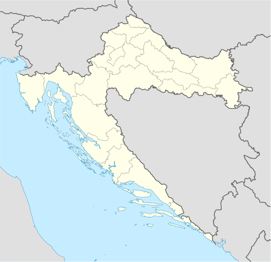
 Mala Subotica Location of Mala Subotica in Croatia | ||
| Coordinates: 46°23′N 16°32′E / 46.383°N 16.533°E | ||
| Country |
| |
| County | Međimurje | |
| Government | ||
| • Municipal mayor | Vladimir Domjanić | |
| Area | ||
| • Total | 34.36 km2 (13.27 sq mi) | |
| Population (2011)[1] | ||
| • Total | 5,452 | |
| • Density | 160/km2 (410/sq mi) | |
| (municipality total) | ||
| Time zone | CET (UTC+1) | |
| • Summer (DST) | CEST (UTC+2) | |
| Postal code | 40321 Mala Subotica | |
| Area code(s) | 040 | |
| Website | www.opcina-mala-subotica.hr | |
Mala Subotica (Hungarian: Kisszabadka; Kajkavian: Murska Sobotica) is a village and municipality in Međimurje County, Croatia.
The village of Mala Subotica is located around 7 kilometres south-east of Čakovec, the county seat and largest city of Međimurje County, and had a population of 1,986 in the 2011 census.[1] During the same census, the entire municipality had a population of 5,452, with 4,728 people identifying themselves as Croats.[2]
Mala Subotica is famous for its developed underground music scene, which comes as a surprise since the village has population of just 2,000 people.
In addition to Mala Subotica, there were five other villages belonging to the municipality during the 2011 census:
- Držimurec – 388 people
- Palovec – 984 people
- Piškorovec – 672 people
- Strelec – 296 people
- Sveti Križ – 410 people
- Štefanec[lower-alpha 1] – 716 people
- Church of Virgin Mary
- Schoenstatt shrine
- Location within Međimurje County
.jpg) Agricultural fields near the village
Agricultural fields near the village Renovated Church of Virgin Mary
Notes
References
- 1 2 "Population by Age and Sex, by Settlements, 2011 Census: Mala Subotica". Census of Population, Households and Dwellings 2011. Zagreb: Croatian Bureau of Statistics. December 2012.
- ↑ "Population by Ethnicity, by Towns/Municipalities, 2011 Census: County of Međimurje". Census of Population, Households and Dwellings 2011. Zagreb: Croatian Bureau of Statistics. December 2012.
- ↑ Croatian Parliament (April 12, 2013). "Zakon o izmjeni i dopuni zakona o područjima županija, gradova i općina u Republici Hrvatskoj". Narodne novine (in Croatian) (44/2013).
External links
- Municipality's website (Croatian)
Coordinates: 46°23′N 16°32′E / 46.383°N 16.533°E


.svg.png)