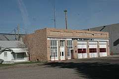
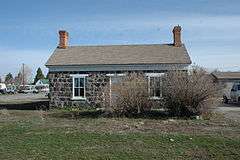
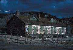
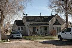
| [3] |
Name on the Register[4] |
Image |
Date listed[5] |
Location |
City or town |
Description |
|---|
| 1 |
John Ashworth House |
|
000000001983-11-29-0000November 29, 1983
(#83003830) |
110 S. 100 West
38°16′19″N 112°38′36″W / 38.271944°N 112.643333°W / 38.271944; -112.643333 (John Ashworth House) |
Beaver |
|
| 2 |
John Ashworth House |
Upload image |
000000001983-11-29-0000November 29, 1983
(#83003828) |
155 S. 200 West
38°16′19″N 112°38′36″W / 38.271944°N 112.643333°W / 38.271944; -112.643333 (John Ashworth House) |
Beaver |
|
| 3 |
James Atkin House |
Upload image |
000000001982-09-17-0000September 17, 1982
(#82004075) |
260 W. 300 North
38°16′43″N 112°38′43″W / 38.278611°N 112.645278°W / 38.278611; -112.645278 (James Atkin House) |
Beaver |
|
| 4 |
Atkins and Smith House |
Upload image |
000000001983-04-15-0000April 15, 1983
(#83004390) |
390 N. 400 West
38°16′43″N 112°38′49″W / 38.278611°N 112.646944°W / 38.278611; -112.646944 (Atkins and Smith House) |
Beaver |
|
| 5 |
Caleb Baldwin House |
Upload image |
000000001983-11-30-0000November 30, 1983
(#83003834) |
195 S. 400 East
38°16′17″N 112°37′59″W / 38.271389°N 112.633056°W / 38.271389; -112.633056 (Caleb Baldwin House) |
Beaver |
|
| 6 |
William Barton House |
Upload image |
000000001982-09-17-0000September 17, 1982
(#82004076) |
295 N. 300 East
38°16′38″N 112°38′11″W / 38.277222°N 112.636389°W / 38.277222; -112.636389 (William Barton House) |
Beaver |
|
| 7 |
Beaver City Library |
|
000000001983-04-15-0000April 15, 1983
(#83004391) |
55 W. Center St.
38°16′24″N 112°38′29″W / 38.273333°N 112.641389°W / 38.273333; -112.641389 (Beaver City Library) |
Beaver |
|
| 8 |
Beaver County Courthouse |
|
000000001970-10-06-0000October 6, 1970
(#70000622) |
90 E. Center St.
38°16′37″N 112°38′25″W / 38.276944°N 112.640278°W / 38.276944; -112.640278 (Beaver County Courthouse) |
Beaver |
|
| 9 |
Beaver Opera House |
|
000000001982-02-11-0000February 11, 1982
(#82004078) |
55 E. Center St.
38°16′29″N 112°38′23″W / 38.274722°N 112.639722°W / 38.274722; -112.639722 (Beaver Opera House) |
Beaver |
|
| 10 |
Beaver Relief Society Meetinghouse |
|
000000001983-11-29-0000November 29, 1983
(#83003837) |
51 N. 100 East
38°16′29″N 112°38′23″W / 38.274722°N 112.639722°W / 38.274722; -112.639722 (Beaver Relief Society Meetinghouse) |
Beaver |
|
| 11 |
Edward Bird House |
|
000000001983-04-15-0000April 15, 1983
(#83004392) |
290 E. Center St.
38°16′24″N 112°38′10″W / 38.273333°N 112.636111°W / 38.273333; -112.636111 (Edward Bird House) |
Beaver |
|
| 12 |
John Black House |
Upload image |
000000001982-09-17-0000September 17, 1982
(#82004079) |
595 N. 100 West
38°16′06″N 112°38′38″W / 38.268333°N 112.643889°W / 38.268333; -112.643889 (John Black House) |
Beaver |
|
| 13 |
Joseph Bohn House |
Upload image |
000000001982-09-17-0000September 17, 1982
(#82004080) |
355 S. 200 West
38°16′06″N 112°38′38″W / 38.268333°N 112.643889°W / 38.268333; -112.643889 (Joseph Bohn House) |
Beaver |
|
| 14 |
Alexander Boyter House |
Upload image |
000000001983-04-15-0000April 15, 1983
(#83004393) |
590 N. 200 West
38°16′54″N 112°38′36″W / 38.281667°N 112.643333°W / 38.281667; -112.643333 (Alexander Boyter House) |
Beaver |
|
| 15 |
James Boyter House |
|
000000001983-04-15-0000April 15, 1983
(#83004394) |
90 W. 200 North
38°16′38″N 112°38′29″W / 38.277222°N 112.641389°W / 38.277222; -112.641389 (James Boyter House) |
Beaver |
|
| 16 |
James Boyter Shop |
|
000000001983-04-15-0000April 15, 1983
(#83004395) |
50 W. 200 North
38°16′38″N 112°38′29″W / 38.277222°N 112.641389°W / 38.277222; -112.641389 (James Boyter Shop) |
Beaver |
|
| 17 |
George Albert Bradshaw House |
Upload image |
000000001983-11-29-0000November 29, 1983
(#83003839) |
265 N. 200 West
38°16′38″N 112°38′42″W / 38.277222°N 112.645°W / 38.277222; -112.645 (George Albert Bradshaw House) |
Beaver |
|
| 18 |
William Burt House |
|
000000001983-11-30-0000November 30, 1983
(#83003841) |
503 E. Center St.
38°16′29″N 112°37′50″W / 38.274722°N 112.630556°W / 38.274722; -112.630556 (William Burt House) |
Beaver |
|
| 19 |
Enoch E. Cowdell House |
Upload image |
000000001982-09-17-0000September 17, 1982
(#82004081) |
595 N. 400 West
38°16′54″N 112°38′54″W / 38.281667°N 112.648333°W / 38.281667; -112.648333 (Enoch E. Cowdell House) |
Beaver |
|
| 20 |
Silas Cox House |
Upload image |
000000001983-11-29-0000November 29, 1983
(#83003844) |
85 S. 400 East
38°16′19″N 112°38′03″W / 38.271944°N 112.634167°W / 38.271944; -112.634167 (Silas Cox House) |
Beaver |
|
| 21 |
Alma Crosby House |
|
000000001983-04-15-0000April 15, 1983
(#83004396) |
115 E. 100 North
38°16′34″N 112°38′17″W / 38.276111°N 112.638056°W / 38.276111; -112.638056 (Alma Crosby House) |
Beaver |
|
| 22 |
Charles A. Dalten House |
|
000000001982-09-17-0000September 17, 1982
(#82004082) |
270 S. 100 West
38°16′14″N 112°38′36″W / 38.270556°N 112.643333°W / 38.270556; -112.643333 (Charles A. Dalten House) |
Beaver |
|
| 23 |
James Heber Dean House |
Upload image |
000000001982-09-17-0000September 17, 1982
(#82004083) |
390 W. 500 North
38°16′54″N 112°38′49″W / 38.281667°N 112.646944°W / 38.281667; -112.646944 (James Heber Dean House) |
Beaver |
|
| 24 |
Erickson House |
Upload image |
000000001982-09-17-0000September 17, 1982
(#82004084) |
290 N. 300 West
38°16′38″N 112°38′42″W / 38.277222°N 112.645°W / 38.277222; -112.645 (Erickson House) |
Beaver |
|
| 25 |
Julia P.M. Farnsworth Barn |
|
000000001982-09-17-0000September 17, 1982
(#82004085) |
180 W. Center St. (rear)
38°16′28″N 112°38′36″W / 38.274444°N 112.643333°W / 38.274444; -112.643333 (Julia P.M. Farnsworth Barn) |
Beaver |
|
| 26 |
Julia Farnsworth House |
|
000000001982-09-17-0000September 17, 1982
(#82004086) |
180 W. Center St.
38°16′28″N 112°38′36″W / 38.274444°N 112.643333°W / 38.274444; -112.643333 (Julia Farnsworth House) |
Beaver |
|
| 27 |
Dr. George Fennemore House |
|
000000001980-02-01-0000February 1, 1980
(#80003885) |
90 S. 100 West
38°16′23″N 112°38′35″W / 38.273056°N 112.643056°W / 38.273056; -112.643056 (Dr. George Fennemore House) |
Beaver |
|
| 28 |
James Fennemore House |
|
000000001983-04-15-0000April 15, 1983
(#83004397) |
195 N. 200 East
38°16′34″N 112°38′17″W / 38.276111°N 112.638056°W / 38.276111; -112.638056 (James Fennemore House) |
Beaver |
|
| 29 |
Edward Fernley House |
|
000000001983-11-29-0000November 29, 1983
(#83003846) |
215 E. 200 North
38°16′38″N 112°38′11″W / 38.277222°N 112.636389°W / 38.277222; -112.636389 (Edward Fernley House) |
Beaver |
|
| 30 |
William Fernley House |
|
000000001983-11-30-0000November 30, 1983
(#83003848) |
1083 E. 200 North
38°16′38″N 112°37′16″W / 38.277222°N 112.621111°W / 38.277222; -112.621111 (William Fernley House) |
Beaver |
|
| 31 |
Fort Cameron |
|
000000001974-09-09-0000September 9, 1974
(#74001932) |
East of Beaver on State Route 153
38°16′44″N 112°36′02″W / 38.278889°N 112.600556°W / 38.278889; -112.600556 (Fort Cameron) |
Beaver |
|
| 32 |
Caroline Fotheringham House |
|
000000001982-09-17-0000September 17, 1982
(#82004087) |
290 N. 600 East
38°16′39″N 112°37′45″W / 38.2775°N 112.629167°W / 38.2775; -112.629167 (Caroline Fotheringham House) |
Beaver |
|
| 33 |
William Fotheringham House |
|
000000001983-04-15-0000April 15, 1983
(#83004403) |
190 W. 100 North
38°16′33″N 112°38′36″W / 38.275833°N 112.643333°W / 38.275833; -112.643333 (William Fotheringham House) |
Beaver |
|
| 34 |
David L. Frazer House |
Upload image |
000000001983-11-30-0000November 30, 1983
(#83003850) |
817 E. 200 North
38°16′37″N 112°37′35″W / 38.276944°N 112.626389°W / 38.276944; -112.626389 (David L. Frazer House) |
Beaver |
|
| 35 |
Thomas Frazer House |
Upload image |
000000001978-11-16-0000November 16, 1978
(#78002650) |
590 N. 300 West
38°16′53″N 112°38′47″W / 38.281389°N 112.646389°W / 38.281389; -112.646389 (Thomas Frazer House) |
Beaver |
|
| 36 |
Frisco Charcoal Kilns |
|
000000001982-03-09-0000March 9, 1982
(#82004793) |
West of Milford off State Route 21
38°27′37″N 113°15′45″W / 38.460278°N 113.2625°W / 38.460278; -113.2625 (Frisco Charcoal Kilns) |
Milford |
|
| 37 |
Henry C. Gale House |
Upload image |
000000001983-11-29-0000November 29, 1983
(#83003851) |
495 N. 100 East
38°16′48″N 112°38′23″W / 38.28°N 112.639722°W / 38.28; -112.639722 (Henry C. Gale House) |
Beaver |
|
| 38 |
Henry C. Gale House |
Upload image |
000000001983-04-15-0000April 15, 1983
(#83004404) |
95 E. 500 North
38°16′54″N 112°38′23″W / 38.281667°N 112.639722°W / 38.281667; -112.639722 (Henry C. Gale House) |
Beaver |
|
| 39 |
William Greenwood House |
|
000000001982-09-17-0000September 17, 1982
(#82004088) |
190 S. 100 West
38°16′19″N 112°38′36″W / 38.271944°N 112.643333°W / 38.271944; -112.643333 (William Greenwood House) |
Beaver |
|
| 40 |
Duckworth Grimshaw House |
Upload image |
000000001980-02-01-0000February 1, 1980
(#80003886) |
95 N. 400 West
38°16′29″N 112°38′54″W / 38.274722°N 112.648333°W / 38.274722; -112.648333 (Duckworth Grimshaw House) |
Beaver |
|
| 41 |
John Grimshaw House |
|
000000001982-09-17-0000September 17, 1982
(#82004089) |
290 N. 200 East
38°16′41″N 112°38′15″W / 38.278056°N 112.6375°W / 38.278056; -112.6375 (John Grimshaw House) |
Beaver |
|
| 42 |
Louis W. Harris Flour Mill |
|
000000001982-09-17-0000September 17, 1982
(#82004090) |
915 E. 200 North
38°16′38″N 112°37′21″W / 38.277222°N 112.6225°W / 38.277222; -112.6225 (Louis W. Harris Flour Mill) |
Beaver |
|
| 43 |
Louis W. Harris House |
|
000000001983-04-15-0000April 15, 1983
(#83004405) |
55 E. 200 North
38°16′39″N 112°38′03″W / 38.2775°N 112.634167°W / 38.2775; -112.634167 (Louis W. Harris House) |
Beaver |
|
| 44 |
Sarah Eliza Harris House |
|
000000001983-04-15-0000April 15, 1983
(#83004406) |
375 E. 200 North
38°16′39″N 112°38′03″W / 38.2775°N 112.634167°W / 38.2775; -112.634167 (Sarah Eliza Harris House) |
Beaver |
|
| 45 |
William and Eliza Hawkins House |
Upload image |
000000001983-11-29-0000November 29, 1983
(#83003852) |
95 E. 200 North
38°16′38″N 112°38′23″W / 38.277222°N 112.639722°W / 38.277222; -112.639722 (William and Eliza Hawkins House) |
Beaver |
|
| 46 |
House at 110 S. 3rd West |
Upload image |
000000001983-11-30-0000November 30, 1983
(#83003861) |
110 S. 300 West
38°16′20″N 112°38′49″W / 38.272222°N 112.646944°W / 38.272222; -112.646944 (House at 110 S. 3rd West) |
Beaver |
|
| 47 |
House at 325 S. Main St. |
|
000000001983-11-30-0000November 30, 1983
(#83003862) |
325 S. Riverside Ln.
38°16′03″N 112°38′24″W / 38.2675°N 112.64°W / 38.2675; -112.64 (House at 325 S. Main St.) |
Beaver |
|
| 48 |
Joseph Huntington House |
Upload image |
000000001983-04-15-0000April 15, 1983
(#83004407) |
215 S. 200 West
38°16′14″N 112°38′36″W / 38.270556°N 112.643333°W / 38.270556; -112.643333 (Joseph Huntington House) |
Beaver |
|
| 49 |
Samuel Jackson House |
|
000000001983-11-30-0000November 30, 1983
(#83003863) |
225 S. 200 East
38°16′14″N 112°38′10″W / 38.270556°N 112.636111°W / 38.270556; -112.636111 (Samuel Jackson House) |
Beaver |
|
| 50 |
Jenner-Griffiths House |
Upload image |
000000001985-05-16-0000May 16, 1985
(#85001118) |
10 N. 300 East
38°12′57″N 112°55′02″W / 38.215833°N 112.917222°W / 38.215833; -112.917222 (Jenner-Griffiths House) |
Minersville |
|
| 51 |
Thomas Jones House |
Upload image |
000000001982-09-17-0000September 17, 1982
(#82004091) |
635 N. 400 West
38°16′57″N 112°38′54″W / 38.2825°N 112.648333°W / 38.2825; -112.648333 (Thomas Jones House) |
Beaver |
|
| 52 |
John Ruphard Lee House |
|
000000001982-09-17-0000September 17, 1982
(#82004092) |
195 N. 100 West
38°16′33″N 112°38′36″W / 38.275833°N 112.643333°W / 38.275833; -112.643333 (John Ruphard Lee House) |
Beaver |
|
| 53 |
Lester Limb House |
Upload image |
000000001982-09-17-0000September 17, 1982
(#82004093) |
495 N. 400 West
38°16′47″N 112°38′54″W / 38.279722°N 112.648333°W / 38.279722; -112.648333 (Lester Limb House) |
Beaver |
|
| 54 |
Low Hotel |
|
000000001983-11-29-0000November 29, 1983
(#83003865) |
95 N. Main St.
38°16′29″N 112°38′29″W / 38.274722°N 112.641389°W / 38.274722; -112.641389 (Low Hotel) |
Beaver |
|
| 55 |
Reinhard Maeser House |
|
000000001983-11-29-0000November 29, 1983
(#83003871) |
285 E. 200 North
38°16′38″N 112°38′11″W / 38.277222°N 112.636389°W / 38.277222; -112.636389 (Reinhard Maeser House) |
Beaver |
|
| 56 |
Mansfield, Murdock and Co. Store |
|
000000001983-11-29-0000November 29, 1983
(#83003868) |
1–11 N. Main St.
38°16′29″N 112°38′29″W / 38.274722°N 112.641389°W / 38.274722; -112.641389 (Mansfield, Murdock and Co. Store) |
Beaver |
|
| 57 |
Mathew McEvan House |
|
000000001983-04-15-0000April 15, 1983
(#83004408) |
205 N. 100 West
38°16′38″N 112°38′36″W / 38.277222°N 112.643333°W / 38.277222; -112.643333 (Mathew McEvan House) |
Beaver |
|
| 58 |
Meeting Hall |
|
000000001982-09-17-0000September 17, 1982
(#82004094) |
1st North and 300 East
38°16′34″N 112°38′10″W / 38.276111°N 112.636111°W / 38.276111; -112.636111 (Meeting Hall) |
Beaver |
|
| 59 |
Minersville City Hall |
Upload image |
000000001985-04-01-0000April 1, 1985
(#85000795) |
60 W. Main St.
38°12′57″N 112°55′27″W / 38.215833°N 112.924167°W / 38.215833; -112.924167 (Minersville City Hall) |
Minersville |
|
| 60 |
William Morgan House |
Upload image |
000000001983-04-15-0000April 15, 1983
(#83004409) |
110 W. 600 North
38°16′57″N 112°38′36″W / 38.2825°N 112.643333°W / 38.2825; -112.643333 (William Morgan House) |
Beaver |
|
| 61 |
Andrew James Morris House |
|
000000001982-09-17-0000September 17, 1982
(#82004095) |
445 E. 100 North
38°16′34″N 112°37′57″W / 38.276111°N 112.6325°W / 38.276111; -112.6325 (Andrew James Morris House) |
Beaver |
|
| 62 |
William Moyes, Jr. House |
Upload image |
000000001983-11-29-0000November 29, 1983
(#83003873) |
395 N. 100 West
38°16′43″N 112°38′36″W / 38.278611°N 112.643333°W / 38.278611; -112.643333 (William Moyes, Jr. House) |
Beaver |
|
| 63 |
Mud Spring |
|
000000001985-06-04-0000June 4, 1985
(#85001231) |
Address Restricted[6]
|
Garrison |
|
| 64 |
David Muir House |
Upload image |
000000001980-11-25-0000November 25, 1980
(#80003887) |
295 N. 300 West
38°16′40″N 112°38′47″W / 38.277778°N 112.646389°W / 38.277778; -112.646389 (David Muir House) |
Beaver |
|
| 65 |
Almira Lott Murdock House |
|
000000001983-11-29-0000November 29, 1983
(#83003878) |
85 W. 100 North
38°16′29″N 112°38′29″W / 38.274722°N 112.641389°W / 38.274722; -112.641389 (Almira Lott Murdock House) |
Beaver |
|
| 66 |
John Riggs and Mary Ellen Wolfenden Murdock House |
|
000000001983-11-29-0000November 29, 1983
(#83003884) |
90 W. 100 North
38°16′33″N 112°38′29″W / 38.275833°N 112.641389°W / 38.275833; -112.641389 (John Riggs and Mary Ellen Wolfenden Murdock House) |
Beaver |
|
| 67 |
Wilson G. Nowers House |
|
000000001983-11-29-0000November 29, 1983
(#83003876) |
195 E. 100 North
38°16′34″N 112°38′17″W / 38.276111°N 112.638056°W / 38.276111; -112.638056 (Wilson G. Nowers House) |
Beaver |
|
| 68 |
Odd Fellows Hall |
|
000000001983-11-29-0000November 29, 1983
(#83003885) |
33-35 N. Main St.
38°16′29″N 112°38′29″W / 38.274722°N 112.641389°W / 38.274722; -112.641389 (Odd Fellows Hall) |
Beaver |
|
| 69 |
Frances A. Olcott House |
Upload image |
000000001983-11-30-0000November 30, 1983
(#83003886) |
590 E. 100 North
38°16′29″N 112°37′50″W / 38.274722°N 112.630556°W / 38.274722; -112.630556 (Frances A. Olcott House) |
Beaver |
|
| 70 |
Jessie Orwin House |
Upload image |
000000001983-11-29-0000November 29, 1983
(#83003888) |
390 W. 600 North
38°16′57″N 112°38′49″W / 38.2825°N 112.646944°W / 38.2825; -112.646944 (Jessie Orwin House) |
Beaver |
|
| 71 |
David Powell House |
Upload image |
000000001983-04-15-0000April 15, 1983
(#83004410) |
115 N. 400 West
38°16′33″N 112°38′55″W / 38.275833°N 112.648611°W / 38.275833; -112.648611 (David Powell House) |
Beaver |
|
| 72 |
Ephraim Orvel Puffer House |
|
000000001983-11-29-0000November 29, 1983
(#83003889) |
195 S. 200 East
38°16′19″N 112°38′10″W / 38.271944°N 112.636111°W / 38.271944; -112.636111 (Ephraim Orvel Puffer House) |
Beaver |
|
| 73 |
Sylvester H. Reeves House |
|
000000001983-11-29-0000November 29, 1983
(#83003890) |
90 N. 200 West
38°16′28″N 112°38′36″W / 38.274444°N 112.643333°W / 38.274444; -112.643333 (Sylvester H. Reeves House) |
Beaver |
|
| 74 |
James E. Robinson House |
|
000000001982-09-17-0000September 17, 1982
(#82004096) |
415 E. 400 North
38°16′47″N 112°37′59″W / 38.279722°N 112.633056°W / 38.279722; -112.633056 (James E. Robinson House) |
Beaver |
|
| 75 |
William Robinson House |
Upload image |
000000001983-11-30-0000November 30, 1983
(#83003891) |
East of Beaver on State Route 153
38°16′37″N 112°36′40″W / 38.276944°N 112.611111°W / 38.276944; -112.611111 (William Robinson House) |
Beaver |
|
| 76 |
William Robinson House |
Upload image |
000000001983-04-15-0000April 15, 1983
(#83004411) |
95 N. 300 West
38°16′28″N 112°38′48″W / 38.274444°N 112.646667°W / 38.274444; -112.646667 (William Robinson House) |
Beaver |
|
| 77 |
Rollins-Eyre House |
Upload image |
000000001995-01-30-0000January 30, 1995
(#94001626) |
113 W. Main St.
38°12′47″N 112°55′41″W / 38.213056°N 112.928056°W / 38.213056; -112.928056 (Rollins-Eyre House) |
Minersville |
|
| 78 |
Ryan Ranch (42 BE 618) |
|
000000001985-06-04-0000June 4, 1985
(#85001232) |
Address Restricted[6]
|
Beaver |
|
| 79 |
School House |
Upload image |
000000001983-11-29-0000November 29, 1983
(#83003892) |
325 N. 200 West
38°16′43″N 112°38′43″W / 38.278611°N 112.645278°W / 38.278611; -112.645278 (School House) |
Beaver |
|
| 80 |
Dr. Warren Shepherd House |
|
000000001983-04-15-0000April 15, 1983
(#83004412) |
60 W. 100 North
38°16′33″N 112°38′29″W / 38.275833°N 112.641389°W / 38.275833; -112.641389 (Dr. Warren Shepherd House) |
Beaver |
|
| 81 |
Harriet S. Shepherd House |
|
000000001980-02-08-0000February 8, 1980
(#80003888) |
190 N. 200 East
38°16′36″N 112°38′13″W / 38.276667°N 112.636944°W / 38.276667; -112.636944 (Harriet S. Shepherd House) |
Beaver |
|
| 82 |
Horace A. Skinner House |
Upload image |
000000001983-11-29-0000November 29, 1983
(#83003894) |
185 S. Main St.
38°16′19″N 112°38′29″W / 38.271944°N 112.641389°W / 38.271944; -112.641389 (Horace A. Skinner House) |
Beaver |
|
| 83 |
Ellen Smith House |
Upload image |
000000001983-11-29-0000November 29, 1983
(#83003896) |
395 N. 300 West
38°16′43″N 112°38′49″W / 38.278611°N 112.646944°W / 38.278611; -112.646944 (Ellen Smith House) |
Beaver |
|
| 84 |
Seth W. Smith House |
|
000000001982-09-17-0000September 17, 1982
(#82004097) |
190 N. 600 East
38°16′33″N 112°37′45″W / 38.275833°N 112.629167°W / 38.275833; -112.629167 (Seth W. Smith House) |
Beaver |
|
| 85 |
William P. Smith House |
Upload image |
000000001983-11-29-0000November 29, 1983
(#83003898) |
190 E. Center St.
38°16′29″N 112°38′17″W / 38.274722°N 112.638056°W / 38.274722; -112.638056 (William P. Smith House) |
Beaver |
|
| 86 |
Mitchell M. Stephens House |
|
000000001983-11-29-0000November 29, 1983
(#83003899) |
495 N. 200 East
38°16′48″N 112°38′17″W / 38.28°N 112.638056°W / 38.28; -112.638056 (Mitchell M. Stephens House) |
Beaver |
|
| 87 |
Robert W. Stoney House |
Upload image |
000000001983-11-30-0000November 30, 1983
(#83003900) |
305 W. 300 North
38°16′43″N 112°38′49″W / 38.278611°N 112.646944°W / 38.278611; -112.646944 (Robert W. Stoney House) |
Beaver |
|
| 88 |
Robert Stoney House |
Upload image |
000000001982-09-17-0000September 17, 1982
(#82004098) |
295 N. 400 West
38°16′33″N 112°38′55″W / 38.275833°N 112.648611°W / 38.275833; -112.648611 (Robert Stoney House) |
Beaver |
|
| 89 |
Structure at 490 E. 200 North |
Upload image |
000000001982-09-17-0000September 17, 1982
(#82004099) |
490 E. 200 North
38°16′34″N 112°37′57″W / 38.276111°N 112.6325°W / 38.276111; -112.6325 (Structure at 490 E. 200 North) |
Beaver |
|
| 90 |
Henry M. Tanner House |
Upload image |
000000001983-04-15-0000April 15, 1983
(#83004413) |
400 North and 300 East
38°16′43″N 112°38′03″W / 38.278611°N 112.634167°W / 38.278611; -112.634167 (Henry M. Tanner House) |
Beaver |
|
| 91 |
Jake Tanner House |
Upload image |
000000001983-11-30-0000November 30, 1983
(#83003901) |
580 S. 200 West
38°15′56″N 112°38′40″W / 38.265556°N 112.644444°W / 38.265556; -112.644444 (Jake Tanner House) |
Beaver |
|
| 92 |
Sidney Tanner House |
Upload image |
000000001983-04-15-0000April 15, 1983
(#83004414) |
195 E. 200 North
38°16′38″N 112°38′17″W / 38.277222°N 112.638056°W / 38.277222; -112.638056 (Sidney Tanner House) |
Beaver |
|
| 93 |
Joseph Tattersall House |
Upload image |
000000001982-09-17-0000September 17, 1982
(#82004100) |
195 N. 400 West
38°16′33″N 112°38′55″W / 38.275833°N 112.648611°W / 38.275833; -112.648611 (Joseph Tattersall House) |
Beaver |
|
| 94 |
Mary I. Thompson House |
|
000000001983-11-30-0000November 30, 1983
(#83003902) |
25 N. 400 East
38°16′29″N 112°37′57″W / 38.274722°N 112.6325°W / 38.274722; -112.6325 (Mary I. Thompson House) |
Beaver |
|
| 95 |
W.O. Thompson House |
Upload image |
000000001982-09-17-0000September 17, 1982
(#82004101) |
415 N. 400 West
38°16′47″N 112°38′54″W / 38.279722°N 112.648333°W / 38.279722; -112.648333 (W.O. Thompson House) |
Beaver |
|
| 96 |
William Thompson House |
|
000000001982-09-17-0000September 17, 1982
(#82004102) |
160 E. Center St.
38°16′24″N 112°38′16″W / 38.273333°N 112.637778°W / 38.273333; -112.637778 (William Thompson House) |
Beaver |
|
| 97 |
William Thompson, Jr. House |
Upload image |
000000001982-09-17-0000September 17, 1982
(#82004103) |
10 W. 400 North
38°16′48″N 112°38′29″W / 38.28°N 112.641389°W / 38.28; -112.641389 (William Thompson, Jr. House) |
Beaver |
|
| 98 |
Edward Tolton House |
Upload image |
000000001982-09-17-0000September 17, 1982
(#82004104) |
210 W. 400 North
38°16′47″N 112°38′43″W / 38.279722°N 112.645278°W / 38.279722; -112.645278 (Edward Tolton House) |
Beaver |
|
| 99 |
J.F. Tolton Grocery |
|
000000001983-11-29-0000November 29, 1983
(#83003905) |
25 N. Main St.
38°16′29″N 112°38′29″W / 38.274722°N 112.641389°W / 38.274722; -112.641389 (J.F. Tolton Grocery) |
Beaver |
|
| 100 |
Walter S. Tolton House |
Upload image |
000000001983-11-29-0000November 29, 1983
(#83003910) |
195 W. 500 North
38°16′47″N 112°38′35″W / 38.279722°N 112.643056°W / 38.279722; -112.643056 (Walter S. Tolton House) |
Beaver |
|
| 101 |
Ancil Twitchell House |
Upload image |
000000001984-02-23-0000February 23, 1984
(#84002146) |
100 S. 200 East
38°16′19″N 112°38′10″W / 38.271944°N 112.636111°W / 38.271944; -112.636111 (Ancil Twitchell House) |
Beaver |
|
| 102 |
Daniel Tyler House |
Upload image |
000000001983-11-29-0000November 29, 1983
(#83003943) |
310 N. Main St.
38°16′43″N 112°38′23″W / 38.278611°N 112.639722°W / 38.278611; -112.639722 (Daniel Tyler House) |
Beaver |
|
| 103 |
Upper Beaver Hydroelectric Power Plant Historic District |
|
000000001989-04-20-0000April 20, 1989
(#89000282) |
State Route 153 10 miles (16 km) east of Beaver
38°16′02″N 112°29′00″W / 38.267222°N 112.483333°W / 38.267222; -112.483333 (Upper Beaver Hydroelectric Power Plant Historic District) |
Beaver |
|
| 104 |
US Post Office-Beaver Main |
|
000000001989-11-27-0000November 27, 1989
(#89001992) |
20 S. Main St.
38°16′26″N 112°38′27″W / 38.273889°N 112.640833°W / 38.273889; -112.640833 (US Post Office-Beaver Main) |
Beaver |
|
| 105 |
Charles Dennis White House |
|
000000001980-02-14-0000February 14, 1980
(#80003889) |
115 E. 400 North
38°16′47″N 112°38′21″W / 38.279861°N 112.639167°W / 38.279861; -112.639167 (Charles Dennis White House) |
Beaver |
|
| 106 |
Maggie Gillies White House |
|
000000001984-02-23-0000February 23, 1984
(#84002149) |
1591 E. 200 North
38°16′38″N 112°36′53″W / 38.277222°N 112.614722°W / 38.277222; -112.614722 (Maggie Gillies White House) |
Beaver |
|
| 107 |
Samuel White House |
Upload image |
000000001983-11-29-0000November 29, 1983
(#83003944) |
315 N. 100 East
38°16′43″N 112°38′23″W / 38.278611°N 112.639722°W / 38.278611; -112.639722 (Samuel White House) |
Beaver |
|
| 108 |
William H. White House |
Upload image |
000000001984-02-23-0000February 23, 1984
(#84002153) |
510 N. 100 East
38°16′54″N 112°38′17″W / 38.281667°N 112.638056°W / 38.281667; -112.638056 (William H. White House) |
Beaver |
|
| 109 |
Wildhorse Canyon Obsidian Quarry |
|
000000001976-05-13-0000May 13, 1976
(#76001810) |
Address Restricted[6]
|
Milford |
An archaeological site, the only known obsidian flow in Utah used by prehistoric peoples as a source of raw materials.
|
| 110 |
Charles Willden House |
Upload image |
000000001983-11-30-0000November 30, 1983
(#83003945) |
190 E. 300 South (rear)
38°16′47″N 112°38′43″W / 38.279722°N 112.645278°W / 38.279722; -112.645278 (Charles Willden House) |
Beaver |
|
| 111 |
Elliot Willden House |
|
000000001983-11-30-0000November 30, 1983
(#83003946) |
340 S. Riverside Ln.
38°16′03″N 112°38′28″W / 38.2675°N 112.641111°W / 38.2675; -112.641111 (Elliot Willden House) |
Beaver |
|
| 112 |
Feargus O'Connor Willden House |
|
000000001983-11-29-0000November 29, 1983
(#83003947) |
120 E. 100 South
38°16′19″N 112°38′16″W / 38.271944°N 112.637778°W / 38.271944; -112.637778 (Feargus O'Connor Willden House) |
Beaver |
|
| 113 |
John Willden House |
Upload image |
000000001982-09-17-0000September 17, 1982
(#82004105) |
495 N. 200 West
38°16′47″N 112°38′43″W / 38.279722°N 112.645278°W / 38.279722; -112.645278 (John Willden House) |
Beaver |
|
| 114 |
John Yardley House |
|
000000001983-11-29-0000November 29, 1983
(#83003948) |
210 S. 100 West
38°16′14″N 112°38′36″W / 38.270556°N 112.643333°W / 38.270556; -112.643333 (John Yardley House) |
Beaver |
|

![]() Media related to National Register of Historic Places in Beaver County, Utah at Wikimedia Commons
Media related to National Register of Historic Places in Beaver County, Utah at Wikimedia Commons


