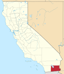
Indian Wells, Imperial County, California
Indian Wells is a former settlement in Imperial County, California.[1] It was located 8 miles (13 km) south-southwest of Seeley.[1]
Indian Wells was a watering place between two Lagunas on the New River found by the Kearny and Cooke Expediditons in 1846. They were subsequently used from the time of the California Gold Rush as a watering place on the Southern Emigrant Trail crossing the Colorado Desert. Its location is described by the 1854-55 Railroad Expedition report:
- "From Sackett's to the Colorado river the desert appears to the unaided eye a perfect level, but it is shown to be undulating, and composed of several gentle slopes or swells of surface rising to a level terrace in the vicinity of Alamo Mocho. The two "lagoons" on the desert being now dry, water is obtained from a well dug in the channel which connects them, at a point about half way between, and 14.5 miles from Sackett's. This watering place is known by the name of "Indian Wells." The water is at a depth of about 30 feet, and is of tolerable quality. From here to Alamo Mocho is a stretch of 20 miles without water, over a surface generally even and free of obstructions."[2]
Indian Wells was a stop on the Butterfield Overland Stage line.[1] The Indian Wells post office, located 10 miles (16 km) west of El Centro operated from 1876 to 1877.[1] The site of Indian Wells was obliterated by the 1906 flood of the New River, when the Colorado River changed course and filled the Salton Sea, scouring a deeper and wider channel for the New River.[1][3]
References
- 1 2 3 4 5 Durham, David L. (1998). California's Geographic Names: A Gazetteer of Historic and Modern Names of the State. Clovis, Calif.: Word Dancer Press. p. 1466. ISBN 1-884995-14-4.
- ↑ Reports of explorations and surveys: to ascertain the most practicable and economical route for a railroad from the Mississippi River to the Pacific Ocean, Volume 7, By United States. War Dept, Joseph Henry, Spencer Fullerton Baird, United States. Army. Corps of Engineers, A.O.P. Nicholson, Printer, Washington D.C., 1857, p.23
- ↑ Tom Jonas, Wells in the Desert, Retracing the Mexican War Trails of Kearny and Cooke through Baja California, The Journal of Arizona History, Vol. 50, No. 3, Autumn 2009, p. 292 and note 40
External links
- View of the Indian Wells Stagecoach station, (ca. 1936) 1931/1941, San Diego History Center (formerly San Diego Historical Society) from calisphere.org. Photo of the ruin of the Indian Wells Stage Station taken by persons unknown obtained by the Society between 1931 and 1941 but it must have been taken before the 1906 flood of the New River.
Coordinates: 32°44′03″N 115°37′11″W / 32.73417°N 115.61972°W
