| [3] |
Name on the Register[4] |
Image |
Date listed[5] |
Location |
City or town |
Description |
|---|
| 1 |
American Legion Post No. 121 |
|
000000001995-06-20-0000June 20, 1995
(#95000758) |
Legion Hut Rd., off Highway 107
35°16′33″N 93°44′03″W / 35.275833°N 93.734167°W / 35.275833; -93.734167 (American Legion Post No. 121) |
Paris |
|
| 2 |
Anhalt Barn |
|
000000001993-02-25-0000February 25, 1993
(#93000087) |
County Road 68
35°17′56″N 93°28′46″W / 35.298889°N 93.479444°W / 35.298889; -93.479444 (Anhalt Barn) |
New Blaine |
|
| 3 |
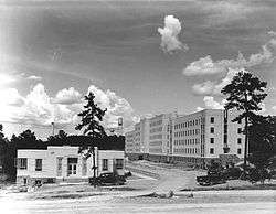
Arkansas Tuberculosis Sanatorium Historic District |
|
000000002006-10-05-0000October 5, 2006
(#06000414) |
Eastern end of Highway 116
35°05′48″N 93°54′54″W / 35.096667°N 93.915°W / 35.096667; -93.915 (Arkansas Tuberculosis Sanatorium Historic District) |
Booneville |
|
| 4 |
Bank of Booneville Building |
|
000000001978-04-26-0000April 26, 1978
(#78000608) |
1 W. Main St.
35°08′26″N 93°55′17″W / 35.140556°N 93.921389°W / 35.140556; -93.921389 (Bank of Booneville Building) |
Booneville |
|
| 5 |
Booneville Commercial Historic District |
|
000000002013-06-04-0000June 4, 2013
(#13000351) |
East side of 100 and 200 blocks of North Broadway Avenue
35°08′22″N 93°55′18″W / 35.139515°N 93.921723°W / 35.139515; -93.921723 (Booneville Commercial Historic District) |
Booneville |
|
| 6 |
Booneville Methodist Episcopal Church South |
|
000000002011-05-25-0000May 25, 2011
(#11000301) |
355 N. Broadway
35°08′28″N 93°55′20″W / 35.141111°N 93.922222°W / 35.141111; -93.922222 (Booneville Methodist Episcopal Church South) |
Booneville |
|
| 7 |
Burnett Springs |
|
000000001995-09-22-0000September 22, 1995
(#95001126) |
End of County Road 704, approximately 1 mile (1.6 km) east of Corley
35°12′58″N 93°38′34″W / 35.216111°N 93.642778°W / 35.216111; -93.642778 (Burnett Springs) |
Corley |
|
| 8 |
Chicago, Rock Island, and Pacific Railroad Depot |
Upload image |
000000001978-02-14-0000February 14, 1978
(#78000607) |
Off Highway 10
35°07′47″N 93°42′34″W / 35.129722°N 93.709444°W / 35.129722; -93.709444 (Chicago, Rock Island, and Pacific Railroad Depot) |
Blue Mountain |
|
| 9 |
Dr. Stephen N. Chism House |
|
000000001994-08-16-0000August 16, 1994
(#94000853) |
Eastern side of Highway 23, south of its junction with Highway 217
35°13′03″N 93°56′23″W / 35.2175°N 93.939722°W / 35.2175; -93.939722 (Dr. Stephen N. Chism House) |
Booneville |
|
| 10 |
Cove Creek Bridge |
|
000000001995-05-26-0000May 26, 1995
(#95000645) |
Highway 309 over Cove Creek
35°11′35″N 93°37′24″W / 35.193056°N 93.623333°W / 35.193056; -93.623333 (Cove Creek Bridge) |
Corley |
|
| 11 |
Cove Creek Tributary Bridge |
|
000000001995-05-26-0000May 26, 1995
(#95000644) |
Highway 309 over a tributary of Cove Creek
35°14′31″N 93°38′22″W / 35.241944°N 93.639444°W / 35.241944; -93.639444 (Cove Creek Tributary Bridge) |
Corley |
|
| 12 |
Cove Lake Bathhouse |
|
000000001995-09-11-0000September 11, 1995
(#94001617) |
Forest Service Rd. 1608A in the Ozark-St. Francis National Forest
35°13′44″N 93°37′45″W / 35.228889°N 93.629167°W / 35.228889; -93.629167 (Cove Lake Bathhouse) |
Corley |
|
| 13 |
Cove Lake Spillway Dam-Bridge |
|
000000001995-09-11-0000September 11, 1995
(#94001618) |
Highway 309, 9 miles (14 km) south of Paris in the Ozark-St. Francis National Forest
35°13′58″N 93°37′45″W / 35.232778°N 93.629167°W / 35.232778; -93.629167 (Cove Lake Spillway Dam-Bridge) |
Corley |
|
| 14 |
Elizabeth Hall |
|
000000001976-05-04-0000May 4, 1976
(#76000428) |
Off Highway 22
35°17′03″N 93°24′32″W / 35.284167°N 93.408889°W / 35.284167; -93.408889 (Elizabeth Hall) |
New Blaine |
|
| 15 |
Farmer's State Bank |
|
000000002002-07-11-0000July 11, 2002
(#02000757) |
100 Seallars St.
35°17′24″N 93°25′16″W / 35.29°N 93.421111°W / 35.29; -93.421111 (Farmer's State Bank) |
New Blaine |
|
| 16 |
Farmers and Merchants Bank-Masonic Lodge |
|
000000001993-11-19-0000November 19, 1993
(#93001257) |
288 N. Broadway
35°08′24″N 93°55′17″W / 35.14°N 93.921389°W / 35.14; -93.921389 (Farmers and Merchants Bank-Masonic Lodge) |
Booneville |
|
| 17 |
First Christian Church |
|
000000001995-06-30-0000June 30, 1995
(#95000791) |
120 E. Walnut St.
35°17′29″N 93°43′41″W / 35.291389°N 93.728056°W / 35.291389; -93.728056 (First Christian Church) |
Paris |
|
| 18 |
John Gabriel Fort House |
|
000000001996-03-28-0000March 28, 1996
(#96000331) |
Reveille Valley Rd., southeast of Driggs
35°12′26″N 93°44′05″W / 35.207222°N 93.734722°W / 35.207222; -93.734722 (John Gabriel Fort House) |
Driggs |
|
| 19 |
Tolbert E. Gill House |
|
000000001993-09-30-0000September 30, 1993
(#93001024) |
Highway 22 west of its junction with Highway 109
35°17′31″N 93°44′00″W / 35.291944°N 93.733333°W / 35.291944; -93.733333 (Tolbert E. Gill House) |
Paris |
|
| 20 |
Jack Creek Bathhouse |
|
000000001993-10-21-0000October 21, 1993
(#93001093) |
Forest Service Road 141, southwest of Sugar Grove, in the Ouachita National Forest
35°02′04″N 93°50′44″W / 35.034444°N 93.845556°W / 35.034444; -93.845556 (Jack Creek Bathhouse) |
Sugar Grove |
|
| 21 |
Freeborn T. Lasater House |
|
000000002002-07-11-0000July 11, 2002
(#02000756) |
494 Highway 197
35°17′22″N 93°25′06″W / 35.289444°N 93.418333°W / 35.289444; -93.418333 (Freeborn T. Lasater House) |
New Blaine |
|
| 22 |
Liberty Schoolhouse |
Upload image |
000000002010-01-21-0000January 21, 2010
(#09001252) |
12682 Spring Lake Rd.
35°11′55″N 93°30′35″W / 35.1985°N 93.5096°W / 35.1985; -93.5096 (Liberty Schoolhouse) |
Corley |
|
| 23 |
Little Rock to Cantonment Gibson Road-Short Mountain Segment |
|
000000002008-01-24-0000January 24, 2008
(#07001429) |
Short Mountain Rd. between Horseshoe Mountain and Short Mountain Creek
35°18′41″N 93°44′39″W / 35.311389°N 93.744167°W / 35.311389; -93.744167 (Little Rock to Cantonment Gibson Road-Short Mountain Segment) |
Paris |
|
| 24 |
Logan County Courthouse, Eastern District |
|
000000001976-07-30-0000July 30, 1976
(#76000429) |
Courthouse Sq.
35°17′32″N 93°43′48″W / 35.292222°N 93.73°W / 35.292222; -93.73 (Logan County Courthouse, Eastern District) |
Paris |
|
| 25 |
Logan County Courthouse, Southern Judicial District |
|
000000001997-03-08-0000March 8, 1997
(#97000207) |
Southeastern corner of the junction of 4th and N. Broadway Sts.
35°08′28″N 93°55′17″W / 35.140973°N 93.921526°W / 35.140973; -93.921526 (Logan County Courthouse, Southern Judicial District) |
Booneville |
|
| 26 |
Magazine City Hall-Jail |
|
000000001993-06-08-0000June 8, 1993
(#93000483) |
Northwest of the junction of Garland and Priddy Sts.
35°09′01″N 93°48′32″W / 35.150278°N 93.808889°W / 35.150278; -93.808889 (Magazine City Hall-Jail) |
Magazine |
|
| 27 |
Main Street Bridge |
|
000000002002-07-11-0000July 11, 2002
(#02000755) |
Sellers St. at Silver Smith Branch
35°17′19″N 93°25′13″W / 35.288611°N 93.420278°W / 35.288611; -93.420278 (Main Street Bridge) |
New Blaine |
|
| 28 |
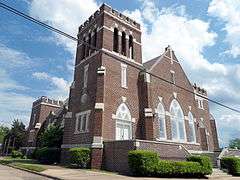
Methodist Episcopal Church, South |
|
000000001995-06-20-0000June 20, 1995
(#95000757) |
205 N. Elm St.
35°17′38″N 93°43′46″W / 35.293889°N 93.729444°W / 35.293889; -93.729444 (Methodist Episcopal Church, South) |
Paris |
|
| 29 |
New Blaine School |
|
000000001992-08-18-0000August 18, 1992
(#92001007) |
Junction of Highway 22 and Spring Rd.
35°17′06″N 93°25′17″W / 35.285°N 93.421389°W / 35.285; -93.421389 (New Blaine School) |
New Blaine |
|
| 30 |
New Liberty School |
|
000000001992-09-10-0000September 10, 1992
(#92001220) |
South of Highway 22
35°16′53″N 93°21′43″W / 35.281389°N 93.361944°W / 35.281389; -93.361944 (New Liberty School) |
Liberty |
|
| 31 |
Old Arkansas Highway 22 |
|
000000002003-09-27-0000September 27, 2003
(#03000950) |
Part of Highway 197, the Highway 197 Loop, and Rainwater Loop
35°17′11″N 93°25′23″W / 35.286389°N 93.423056°W / 35.286389; -93.423056 (Old Arkansas Highway 22) |
New Blaine |
|
| 32 |
Old Logan County Jail |
|
000000001993-11-19-0000November 19, 1993
(#93001254) |
204 N. Vine St.
35°17′37″N 93°43′54″W / 35.293611°N 93.731667°W / 35.293611; -93.731667 (Old Logan County Jail) |
Paris |
|
| 33 |
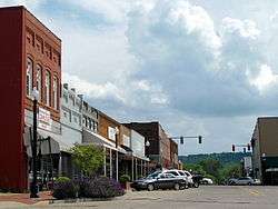
Paris Commercial Historic District |
|
000000002009-05-12-0000May 12, 2009
(#09000314) |
Roughly bounded by N. Express, Short Mountain, N. 1st, E. Pine, and E. and W. Academy Sts.
35°17′31″N 93°43′48″W / 35.292033°N 93.729917°W / 35.292033; -93.729917 (Paris Commercial Historic District) |
Paris |
|
| 34 |
Paris Post Office |
|
000000001998-08-14-0000August 14, 1998
(#98000923) |
206 N. Elm St.
35°17′39″N 93°43′47″W / 35.294167°N 93.729722°W / 35.294167; -93.729722 (Paris Post Office) |
Paris |
|
| 35 |
Park Hill |
|
000000002013-01-29-0000January 29, 2013
(#12001233) |
400 E. Wahl St.
35°17′05″N 93°43′35″W / 35.284654°N 93.726386°W / 35.284654; -93.726386 (Park Hill) |
Paris |
|
| 36 |
Petit Jean River Bridge |
Upload image |
000000001995-05-26-0000May 26, 1995
(#95000646) |
Highway 109 over the Petit Jean River
35°05′48″N 93°48′03″W / 35.096667°N 93.800833°W / 35.096667; -93.800833 (Petit Jean River Bridge) |
Sugar Grove |
|
| 37 |
Saint Anthony's Catholic Church |
|
000000001986-08-21-0000August 21, 1986
(#86001885) |
North of Highway 22
35°18′48″N 93°52′55″W / 35.313333°N 93.881944°W / 35.313333; -93.881944 (Saint Anthony's Catholic Church) |
Ratcliff |
|
| 38 |
Schriver House |
|
000000001995-09-22-0000September 22, 1995
(#95001125) |
Leo Ave., north of its junction with Highway 22
35°18′08″N 93°39′01″W / 35.302222°N 93.650278°W / 35.302222; -93.650278 (Schriver House) |
Subiaco |
|
| 39 |
Short Mountain Creek Bridge |
|
000000002004-09-24-0000September 24, 2004
(#04001039) |
County Road 64
35°18′41″N 93°44′37″W / 35.311389°N 93.743611°W / 35.311389; -93.743611 (Short Mountain Creek Bridge) |
Paris |
|
| 40 |
Smith Hospital |
|
000000001994-04-11-0000April 11, 1994
(#94000369) |
Northern terminus of Express St.
35°17′53″N 93°43′50″W / 35.298056°N 93.730556°W / 35.298056; -93.730556 (Smith Hospital) |
Paris |
|
| 41 |
Troy Lasater Service Station |
|
000000002002-10-04-0000October 4, 2002
(#02001075) |
Highway 197 Loop
35°17′20″N 93°25′11″W / 35.288889°N 93.419722°W / 35.288889; -93.419722 (Troy Lasater Service Station) |
New Blaine |
|
| 42 |
Union Church and School |
|
000000002005-06-01-0000June 1, 2005
(#05000497) |
2158 Union Rd.
35°19′24″N 93°39′52″W / 35.3234°N 93.6645°W / 35.3234; -93.6645 (Union Church and School) |
Paris |
Now used as the Union School Heritage Center
|
| 43 |
Evelyn Gill Walker House |
|
000000001993-09-16-0000September 16, 1993
(#93000985) |
18 S. Spruce St.
35°17′30″N 93°44′00″W / 35.291667°N 93.733333°W / 35.291667; -93.733333 (Evelyn Gill Walker House) |
Paris |
|
%2C_Paris%2C_AR_002.jpg)
