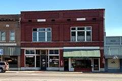
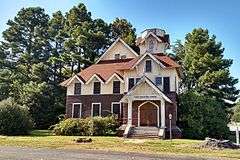
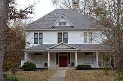
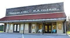
[3] |
Name on the Register[4] |
Image |
Date listed[5] |
Location |
City or town |
Description |
1 |
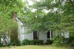
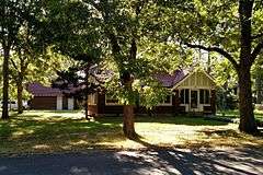
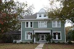
Ashley-Alexander House |
|
000000001976-06-18-0000June 18, 1976 (#76000431) |
North of Scott 34°42′21″N 92°05′33″W / 34.705833°N 92.0925°W / 34.705833; -92.0925 (Ashley-Alexander House) |
Scott |
|
2 |
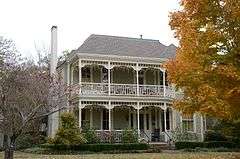
Thomas Sloan Boyd House |
|
000000001976-01-01-0000January 1, 1976 (#76000430) |
220 Park Ave. 34°46′55″N 91°54′07″W / 34.781944°N 91.901944°W / 34.781944; -91.901944 (Thomas Sloan Boyd House) |
Lonoke |
|
3 |
Camp Nelson Confederate Cemetery |
|
000000001996-05-03-0000May 3, 1996 (#96000503) |
Rye St., approximately 1 mile northwest of the junction of Highways 319 and 321 34°56′46″N 91°58′49″W / 34.946111°N 91.980278°W / 34.946111; -91.980278 (Camp Nelson Confederate Cemetery) |
Cabot |
|
4 |
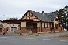
Carlisle Rock Island Depot |
|
000000001990-06-14-0000June 14, 1990 (#90000905) |
Junction of Main St. and Court Ave. 34°46′58″N 91°44′46″W / 34.782778°N 91.746111°W / 34.782778; -91.746111 (Carlisle Rock Island Depot) |
Carlisle |
|
5 |
Carver Gymnasium |
Upload image |
000000002009-09-23-0000September 23, 2009 (#09000741) |
400 Ferguson St. 34°46′51″N 91°53′47″W / 34.780875°N 91.896497°W / 34.780875; -91.896497 (Carver Gymnasium) |
Lonoke |
|
6 |
Coy Mound Site |
|
000000001995-09-22-0000September 22, 1995 (#95001120) |
Next to Indian-Bakers Bayou 34°32′56″N 91°53′24″W / 34.54895°N 91.8899°W / 34.54895; -91.8899 (Coy Mound Site) |
Coy |
|
7 |
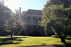
Dortch Plantation |
|
000000001975-12-06-0000December 6, 1975 (#75000397) |
Northeast of Scott off Highway 130 at Bearskin Lake 34°42′55″N 92°03′13″W / 34.715278°N 92.053611°W / 34.715278; -92.053611 (Dortch Plantation) |
Scott |
|
8 |
Eagle House |
|
000000001982-12-22-0000December 22, 1982 (#82000858) |
217 Ash St. 34°46′57″N 91°54′06″W / 34.7825°N 91.901667°W / 34.7825; -91.901667 (Eagle House) |
Lonoke |
|
9 |
Joe P. Eagle and D. R. Boone Building |
|
000000001994-12-09-0000December 9, 1994 (#94001462) |
105-107 W. Front St. 34°47′01″N 91°54′01″W / 34.783611°N 91.900278°W / 34.783611; -91.900278 (Joe P. Eagle and D. R. Boone Building) |
Lonoke |
|
10 |
First Christian Church |
|
000000001997-07-09-0000July 9, 1997 (#97000748) |
Junction of 2nd and Depot Sts. 34°47′07″N 91°54′04″W / 34.785278°N 91.901111°W / 34.785278; -91.901111 (First Christian Church) |
Lonoke |
|
11 |
First Presbyterian Church |
|
000000002004-09-23-0000September 23, 2004 (#04001037) |
304 S. Center St. 34°46′53″N 91°54′01″W / 34.781389°N 91.900278°W / 34.781389; -91.900278 (First Presbyterian Church) |
Lonoke |
|
12 |
W.P. Fletcher House |
|
000000001990-09-05-0000September 5, 1990 (#90001373) |
604 W. 4th St. 34°47′14″N 91°54′19″W / 34.787222°N 91.905278°W / 34.787222; -91.905278 (W.P. Fletcher House) |
Lonoke |
|
13 |
Keo Commercial Historic District |
|
000000002011-06-15-0000June 15, 2011 (#11000355) |
Main & Fleming Sts., Arkansas Highway 232 34°36′02″N 92°00′33″W / 34.600556°N 92.009167°W / 34.600556; -92.009167 (Keo Commercial Historic District) |
Keo |
Cotton and Rice Farm History and Architecture in the Arkansas Delta MPS
|
14 |
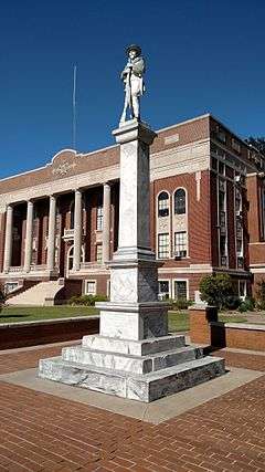
Lonoke Confederate Monument |
|
000000001996-05-03-0000May 3, 1996 (#96000508) |
On the courthouse lawn, near the junction of 3rd and Center Sts. 34°47′09″N 91°53′58″W / 34.785833°N 91.899444°W / 34.785833; -91.899444 (Lonoke Confederate Monument) |
Lonoke |
|
15 |
Lonoke County Courthouse |
|
000000001982-06-08-0000June 8, 1982 (#82002121) |
N. Center St. 34°47′09″N 91°53′57″W / 34.785833°N 91.899167°W / 34.785833; -91.899167 (Lonoke County Courthouse) |
Lonoke |
|
16 |
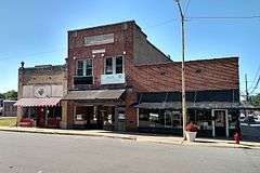
Lonoke Downtown Historic District |
|
000000001996-05-10-0000May 10, 1996 (#96000528) |
Junction of Front and Center Sts. 34°47′05″N 91°53′58″W / 34.784722°N 91.899444°W / 34.784722; -91.899444 (Lonoke Downtown Historic District) |
Lonoke |
|
17 |
Memphis to Little Rock Road-Bayou Two Prairie Segment |
Upload image |
000000002006-09-20-0000September 20, 2006 (#06000836) |
Address Restricted
|
Brownsville |
A segment of the Trail of Tears[6]
|
18 |
Memphis to Little Rock Road-Brownsville Segment |
Upload image |
000000002003-09-27-0000September 27, 2003 (#03000954) |
Address Restricted
|
Brownsville |
A segment of the Trail of Tears[6]
|
19 |
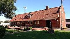
Rock Island Depot |
|
000000001984-10-04-0000October 4, 1984 (#84000006) |
U.S. Route 70 and Center St. 34°47′02″N 91°54′02″W / 34.783889°N 91.900556°W / 34.783889; -91.900556 (Rock Island Depot) |
Lonoke |
|
20 |
Sears House |
|
000000001992-08-05-0000August 5, 1992 (#92000952) |
Southeast of the junction of Highways 38 and 319 34°59′05″N 91°57′43″W / 34.984722°N 91.961944°W / 34.984722; -91.961944 (Sears House) |
Austin |
|
21 |
Shull House |
|
000000001982-12-22-0000December 22, 1982 (#82000859) |
418 Park 34°46′48″N 91°54′05″W / 34.78°N 91.901389°W / 34.78; -91.901389 (Shull House) |
Lonoke |
|
22 |
Toltec Mounds |
|
000000001973-01-12-0000January 12, 1973 (#73000382) |
Off United States Route 165 34°38′49″N 92°03′55″W / 34.646944°N 92.065278°W / 34.646944; -92.065278 (Toltec Mounds) |
Scott |
State park
|
23 |
Trimble House |
|
000000001982-12-22-0000December 22, 1982 (#82000860) |
518 Center St. 34°46′46″N 91°53′59″W / 34.779444°N 91.899722°W / 34.779444; -91.899722 (Trimble House) |
Lonoke |
|
24 |
Trimble-McCrary House |
|
000000002004-09-24-0000September 24, 2004 (#04001038) |
516 Jefferson 34°46′45″N 91°54′10″W / 34.779167°N 91.902778°W / 34.779167; -91.902778 (Trimble-McCrary House) |
Lonoke |
|
25 |
US 70, Union Valley Segment |
|
000000002004-09-23-0000September 23, 2004 (#04001040) |
North and south of U.S. Route 70 from the S28/S29 boundary line R9W west to the S26/S27 boundary line R10W 34°45′56″N 92°01′25″W / 34.765556°N 92.023611°W / 34.765556; -92.023611 (US 70, Union Valley Segment) |
Union Valley |
|
26 |
Dr. E.F. Utley House |
|
000000001998-06-03-0000June 3, 1998 (#98000623) |
401 W. Pine St. 35°00′43″N 92°01′04″W / 35.011944°N 92.017778°W / 35.011944; -92.017778 (Dr. E.F. Utley House) |
Cabot |
|
27 |
Walls Farm Barn and Corn Crib |
Upload image |
000000001995-11-29-0000November 29, 1995 (#95001379) |
Highway 31 north of Tomberlin 34°31′26″N 91°52′26″W / 34.523889°N 91.873889°W / 34.523889; -91.873889 (Walls Farm Barn and Corn Crib) |
Tomberlin |
Destroyed
|
28 |
Walls House |
|
000000001982-12-22-0000December 22, 1982 (#82000861) |
406 Jefferson St. 34°46′49″N 91°54′12″W / 34.780278°N 91.903333°W / 34.780278; -91.903333 (Walls House) |
Lonoke |
|
29 |
Wheat House |
|
000000001982-12-22-0000December 22, 1982 (#82000862) |
600 Center St. 34°46′43″N 91°53′59″W / 34.778611°N 91.899722°W / 34.778611; -91.899722 (Wheat House) |
Lonoke |
|
30 |
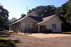
Woodlawn School Building |
|
000000001993-02-25-0000February 25, 1993 (#93000086) |
Northwest of the junction of Highway 31 and Bizzell Rd. 34°55′22″N 91°52′30″W / 34.922778°N 91.875°W / 34.922778; -91.875 (Woodlawn School Building) |
Woodlawn |
|